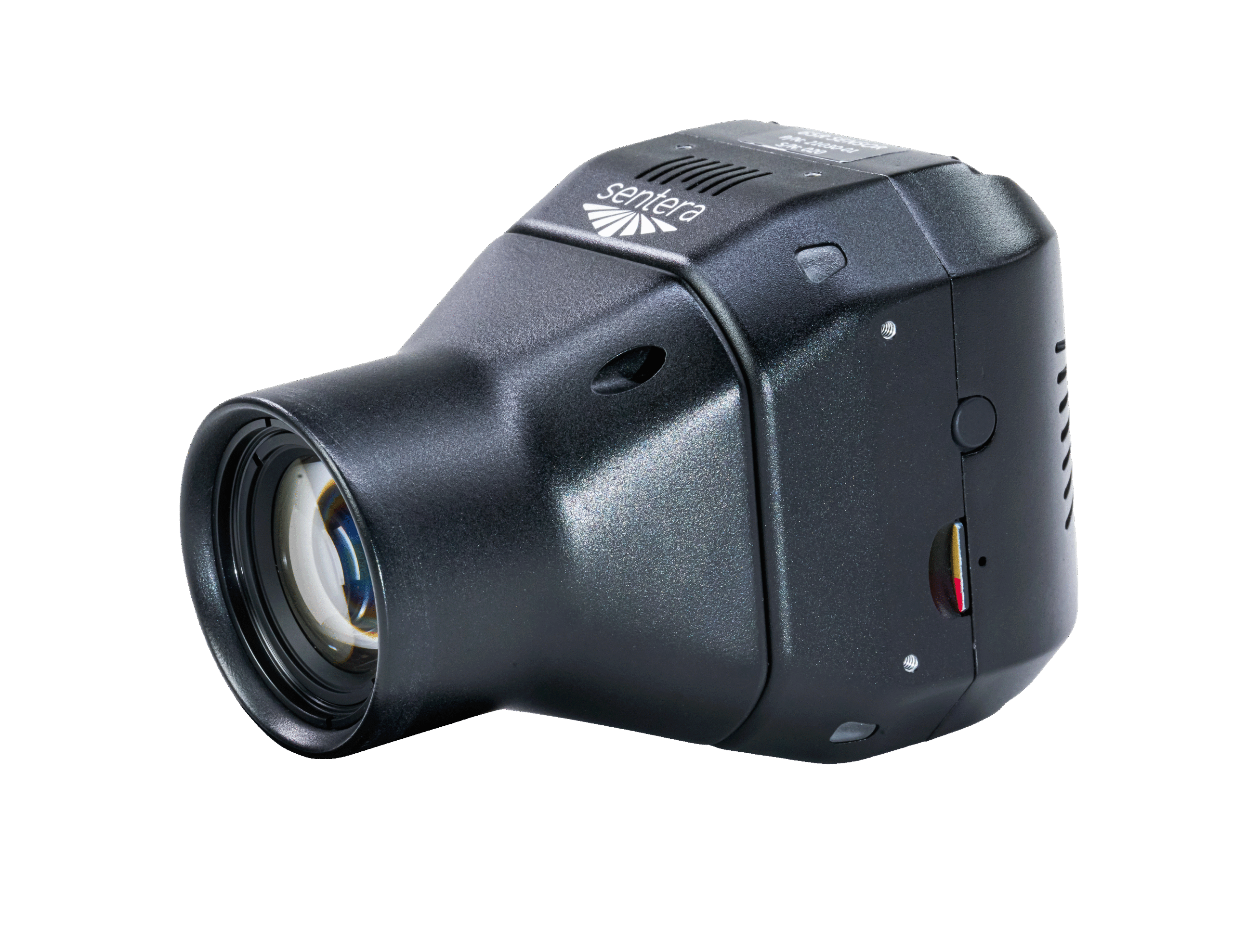
Sentera 65R Global Shutter Sensor
Global Shutter High Resolution Aerial Imagery
The Sentera 65R Sensor offers 65-megapixel global shutter RGB imagery optimized for drone operations. Its compact, lightweight design extends flight times, enhancing efficiency. With a resolution of 9344 x 7000 pixels, 3 FPS capture rate, lens variants, and live video, it ensures exceptional detail. The 65R offers plug-and-play compatibility with Harris Aerial's heavy-lift Carrier drone platforms, making it ideal for long-endurance, large-area coverage. It empowers professionals to make informed decisions with high-resolution data, significantly reducing the number of images needed for comprehensive coverage.
Cutting-Edge Imaging for Mapping and Modeling
Distortion-Free Imagery at Any Speed
Rolling shutters introduce motion artifacts in high-speed flight, distorting linear features like power lines and roads. The 65R's global shutter captures every pixel simultaneously, eliminating skew and ensuring precise geospatial accuracy.
Maximize Productivity
The global shutter, 3 FPS capture rate, real-time video, and gimbal stabilization enable quicker and longer flights without compromising data quality, meaning you can cover more ground significantly faster than any other camera on the market.
Ease of Use
Plug-and-play integration, time-of-capture geo-tagging, and ample internal storage reduce training requirements and streamline workflows.
65R data is supported in most major image processing platforms, which means the data is ready for image processing immediately after flight.
Optimized for High-Frequency Data Collection
Designed for thousands of captures per flight, the 65R excels in high-speed, high-volume applications like surveying, infrastructure inspection, and precision mapping — without risk of shutter degradation.
Exceptional Color Quality
Large sensor size and high-quality lens system capture rich details and accurate colors, ensuring controlled color quality without creative or artistic modes.
Live Video
Monitor real-time footage, ensuring optimal positioning to capture critical moments. This feature enhances situational awareness, enables instant decision-making, and facilitates adjustments mid-flight, leading to more precise and comprehensive data collection.
Request a Demo
65R Full Specifications
| Specification | Value |
|---|---|
| NDAA Compliant | Yes |
| Sensor Resolution | 9344 × 7000 px |
| Sensor | Gpixel GMAX 3265 |
| Sensor Size | 29.9 mm (W) × 22.4 mm (H) |
| Shutter Type | Global |
| Pixel Pitch | 3.2 µm |
| Focal Length Options | 27mm / 60mm |
| GSD @ 120m AGL (27mm) | 1.4 cm/px |
| Capture Rate | 3 FPS (0.333 s) |
| Storage | 512 GB NVMe SSD |
| Bit Depth | 8-bit |
| Image Formats | JPEG |
| Live Video | 960 × 720 @ 18 FPS |
| Weight (with Smart Dovetail gimbal) | 588 g |
| Interface | USB-C 3.0, Gigabit Ethernet, PPS, Serial, Discrete I/O |
| Metadata & Geotagging | Written at time of capture |
| Spec Sheet | Download 65R Spec Sheet (PDF) |
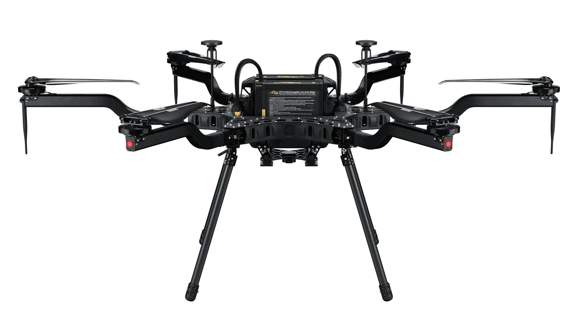
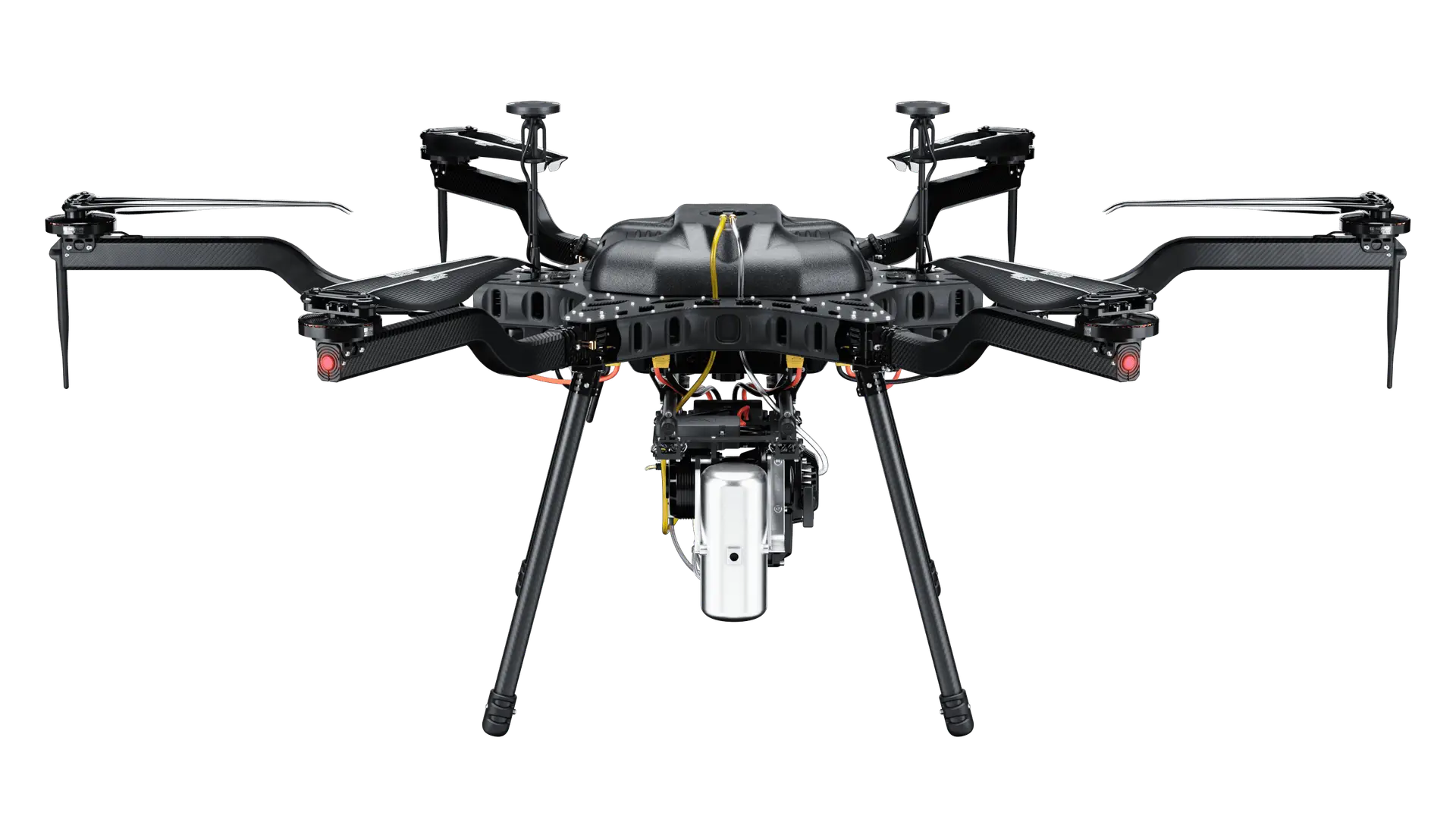
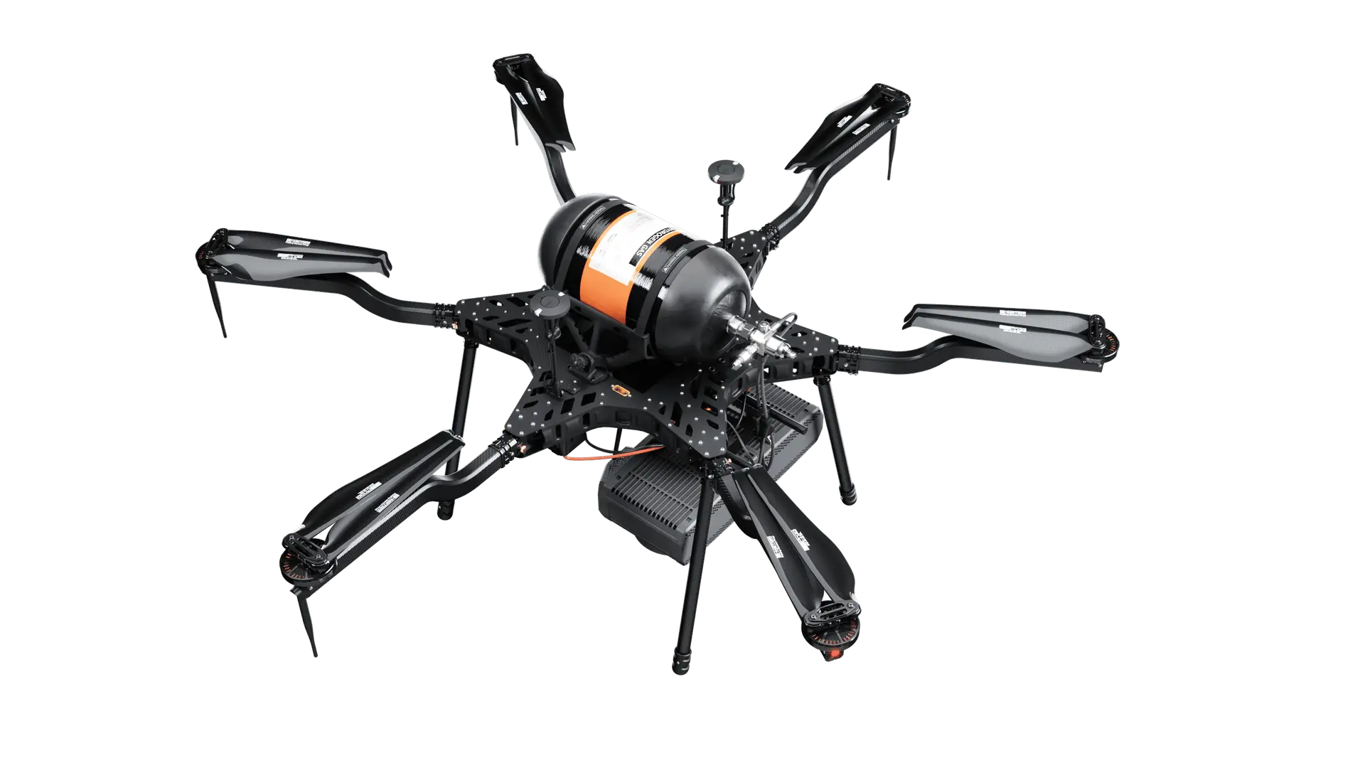
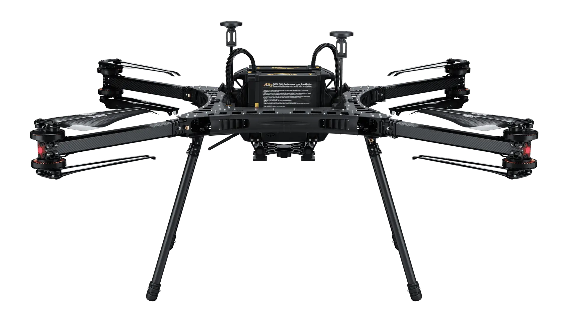
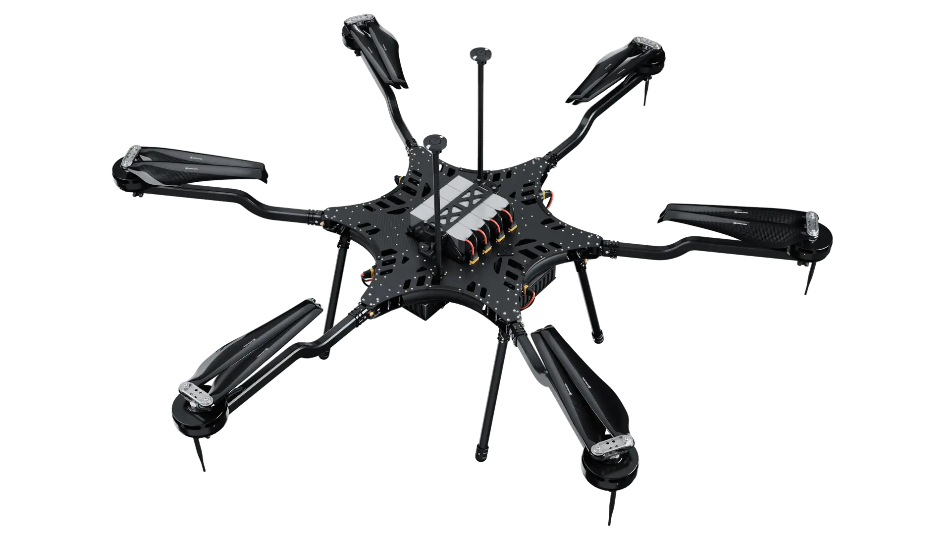
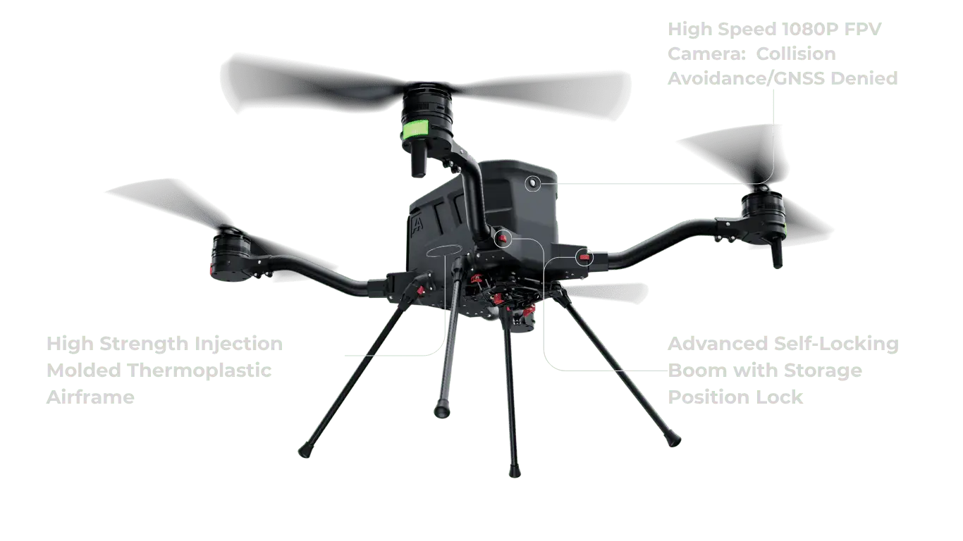
Compatible with Harris Aerial Carrier Drones
The 65R integrates with Harris Aerial's full Carrier drone lineup. Pairing the sensor's resolution, image clarity, reliability, and efficiency with the payload capacity and flight endurance of the aircraft makes it the ideal choice for high-performance aerial imaging.
Built for Demanding Mapping Workflows
Aerial Photogrammetry
Generate 3D point clouds, orthomosaic maps, and digital elevation models with sub-2cm GSD from a single flight.
Construction Monitoring
Track earthworks progress, calculate cut/fill volumes, and document site changes with high-accuracy aerial imagery throughout a project lifecycle.
Precision Agriculture
Capture the high-resolution base maps and orthomosaics used to support application, field boundaries, and agronomic planning.
Infrastructure Inspection
Inspect bridges, pipeline corridors, and roadways with enough image resolution to detect surface-level defects from altitude.
Topographic Surveying
Support land survey workflows, cadastral mapping, and topographic data collection with geodetically accurate 65MP imagery.
Emergency Response
Document disaster scenes, flood extents, wildfire perimeters, and infrastructure damage with the resolution needed for actionable response planning.
Frequently Asked Questions
Ready to Elevate Your Mapping Operation?
The Sentera 65R paired with a Harris Aerial Carrier drone is the professional mapping platform your operation demands. Let's build your configuration.