USA-Made · NDAA-Compliant Drones
Harris Aerial — USA-Made Heavy-Lift Drone
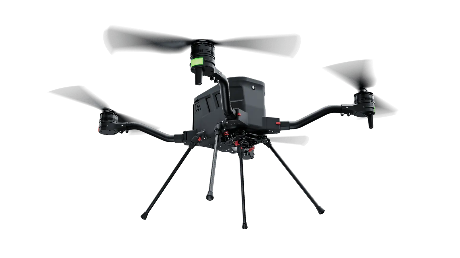
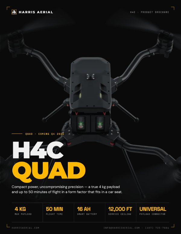
Compact Power. Uncompromising Precision.
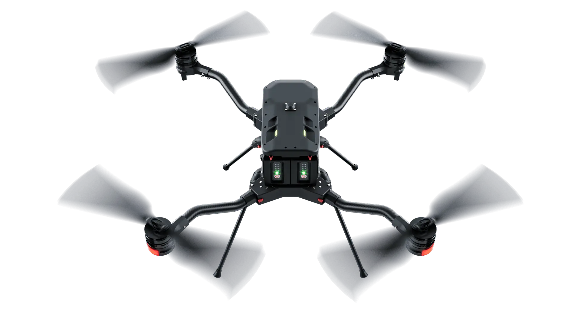
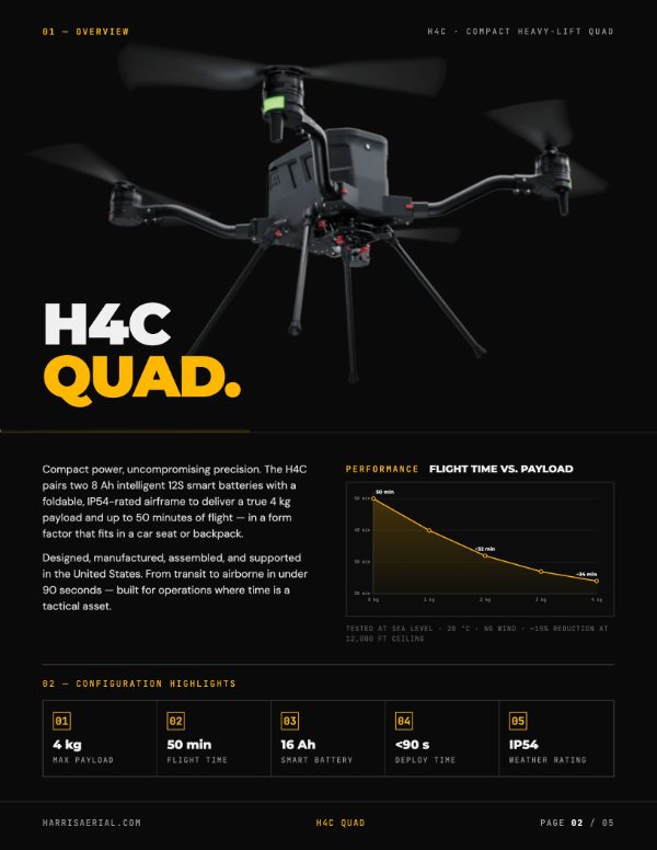
Compact power. Uncompromising precision. The H4C pairs two massive 8 Ah intelligent 12S smart batteries with a foldable, IP54-rated airframe to deliver a true 4 kg payload and up to 50 minutes of flight — in a form factor that fits in a car seat or backpack.
Designed, manufactured, assembled, and supported in the United States. When mission success is non-negotiable, the H4C is your platform.
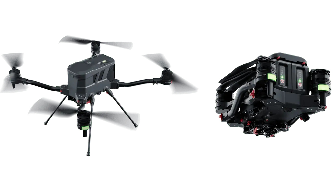
The H4C's proprietary airframe is injection molded from aerospace-grade thermoplastics giving the best durability and strength-to-weight ratio in its class. Every component on the H4C is over-engineered to handle the full-rated 4 kg payload with structural margin to spare.
IP54-rated electronics bay keeps sensitive components protected in rain, dust, and field-level abuse that would destroy lesser platforms.
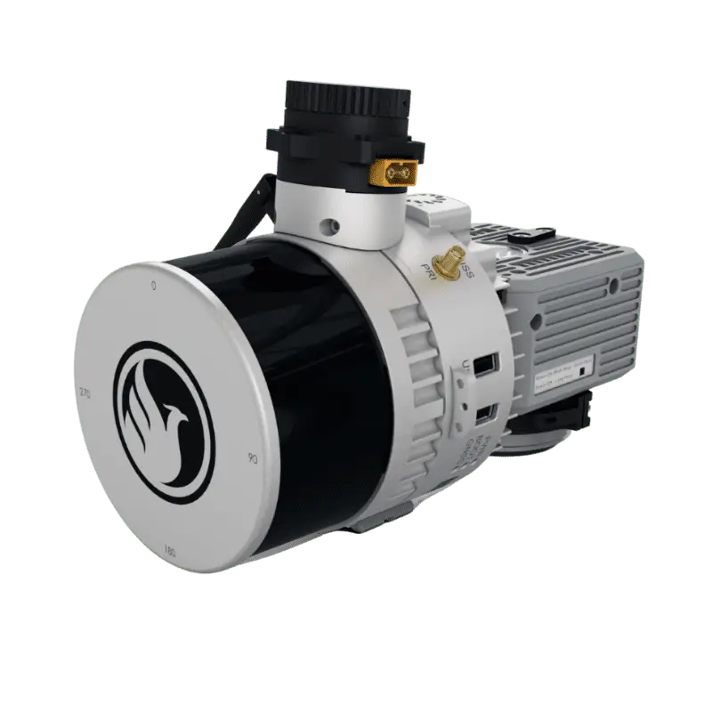
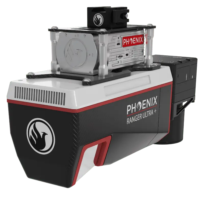
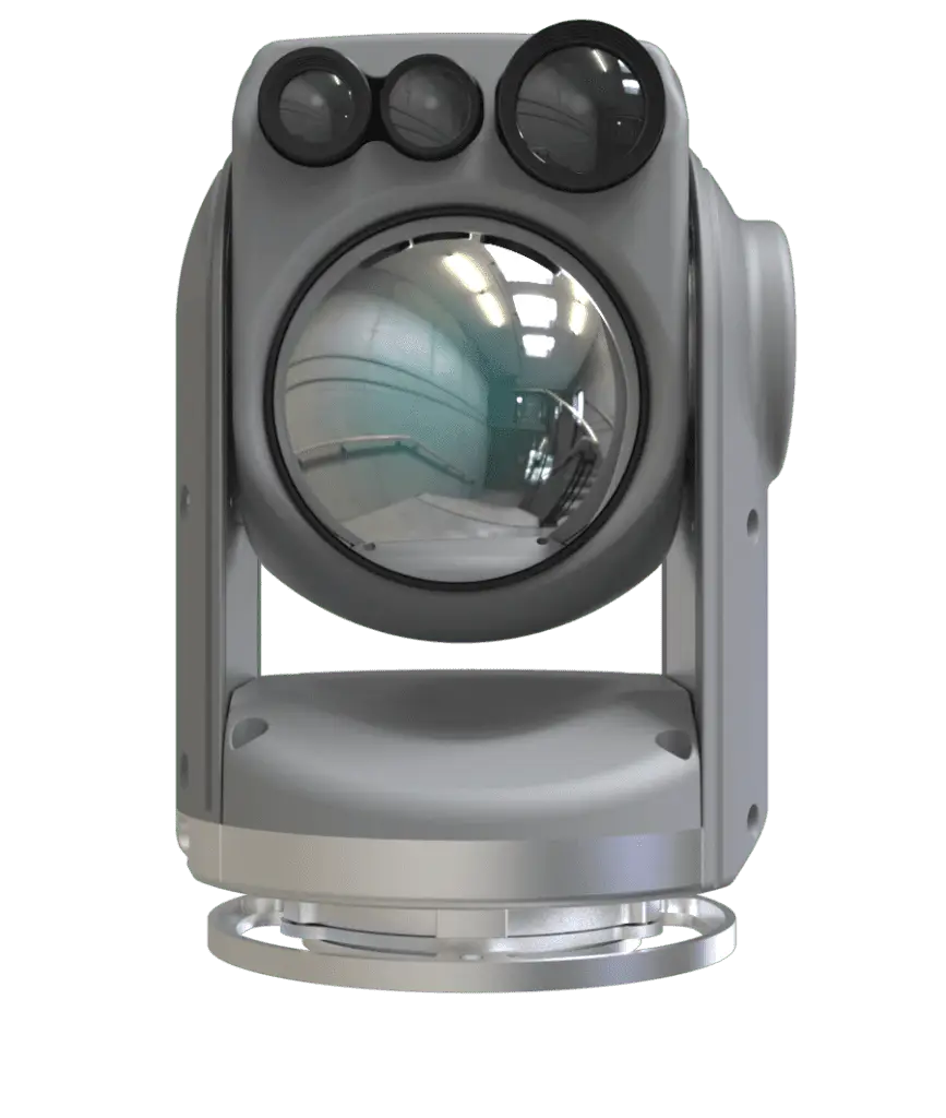
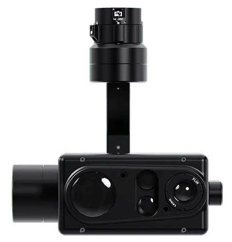
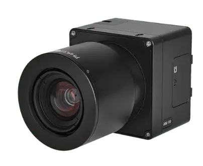
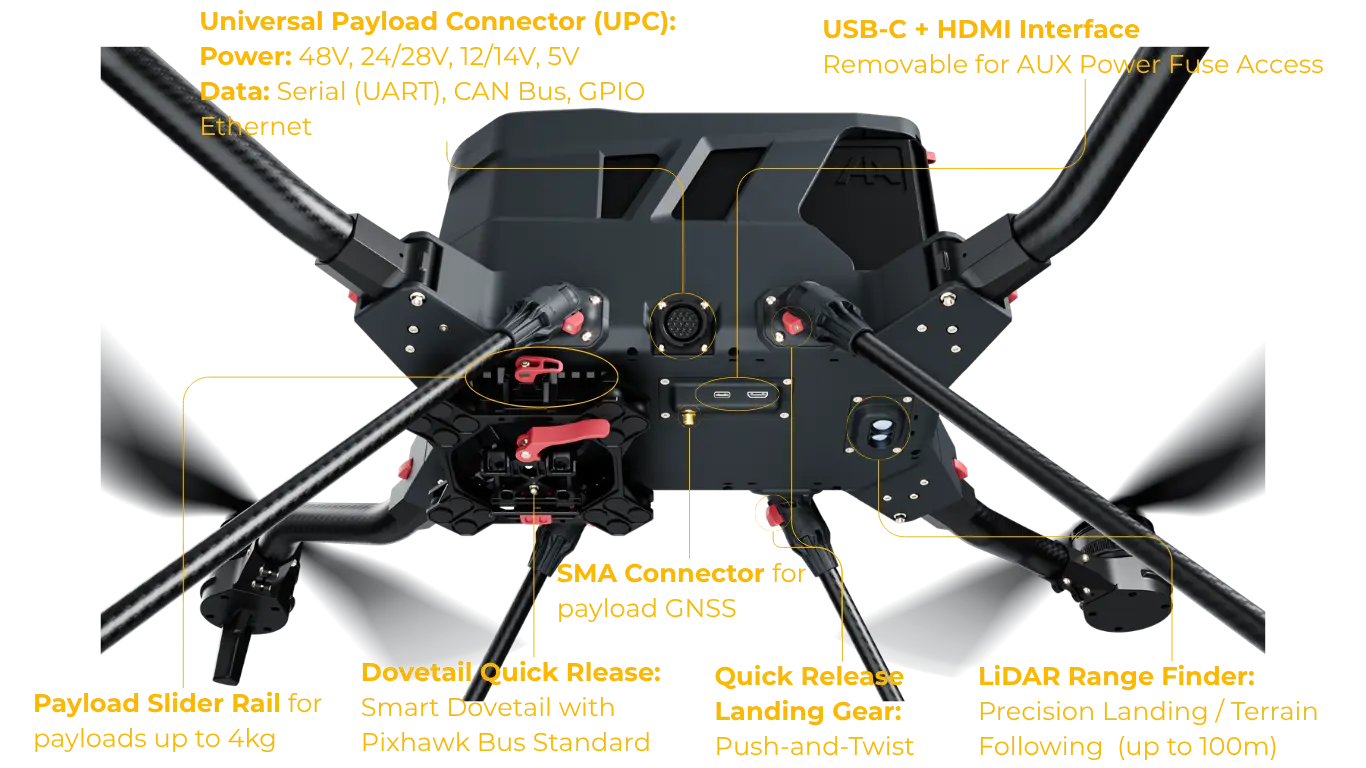
A dampened modular quick-release mount puts any sensor or payload in the air in 45 seconds. The H4C's 4 kg / 8.8 lb capacity handles the full library of professional payloads — survey, mapping, thermal, multispectral, and custom cargo — without singular dependence on any one manufacturer.
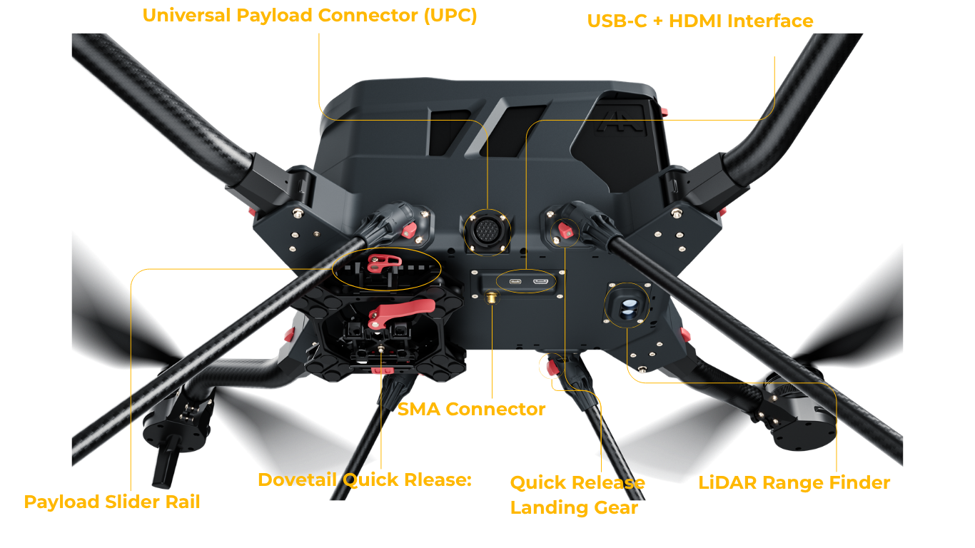
Configurable aux power (48V vbat, 24/28V, 12/14V, 5V) and a full data interface stack (Ethernet, UART, CAN, GPIO, HDMI, USB-C) mean any sensor in your kit goes airborne the same way — bring your own, mount it, fly.
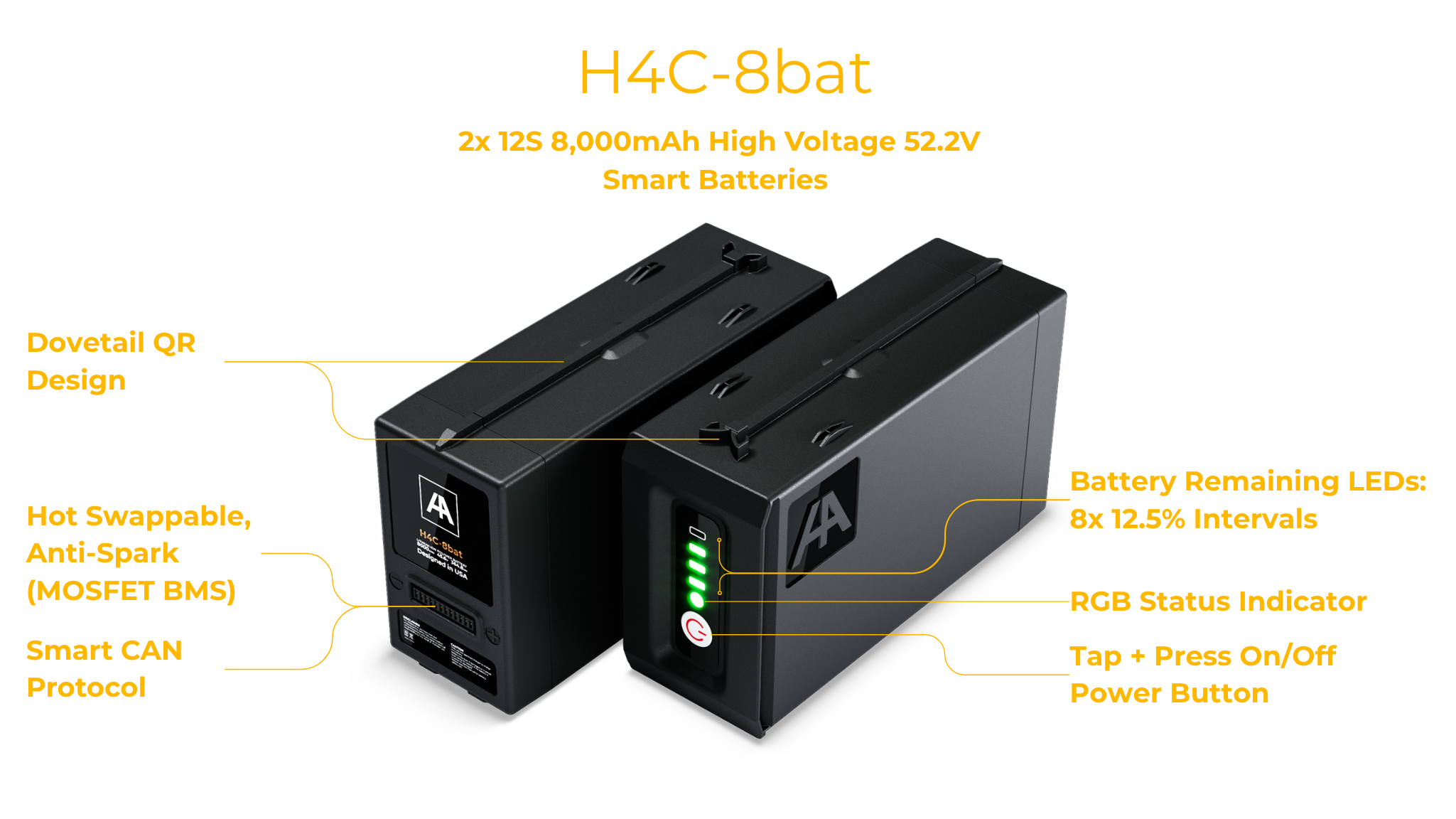
The H4C operates with two intelligent 12S smart batteries in parallel — 8 Ah each, 16 Ah combined — delivering redundant power distribution and a class-leading 50-minute flight time unloaded, with a duration of over 24 minutes with a maximum 4 kg payload.
Hot-swap compatible. Battery installation and removal takes under 30 seconds in the field, maximizing operational tempo between sorties.
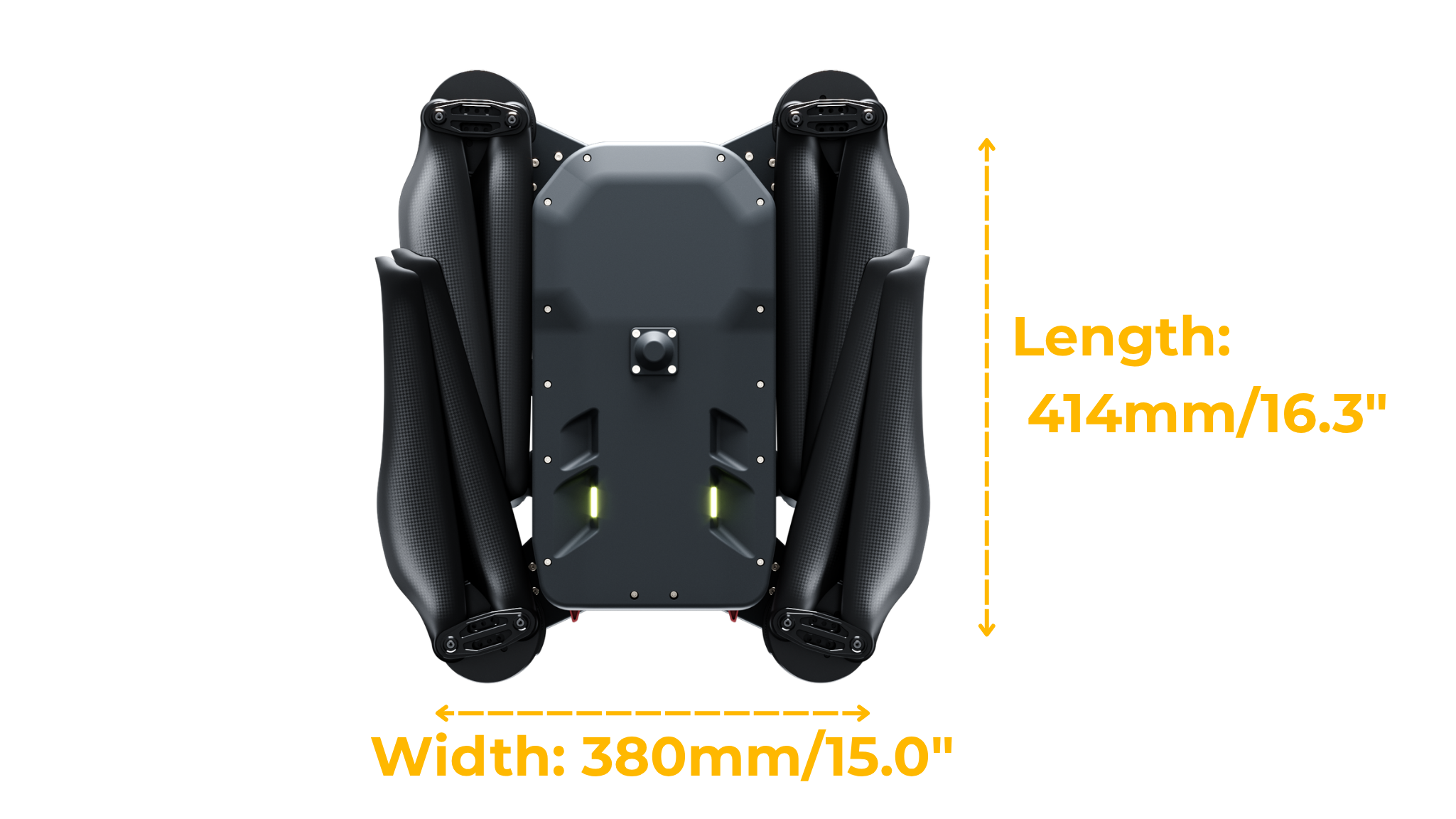
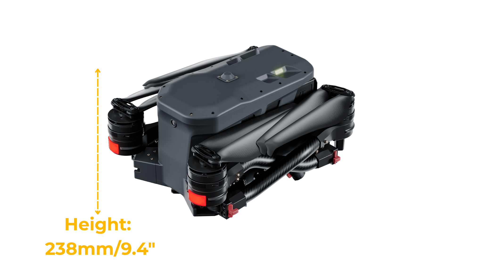
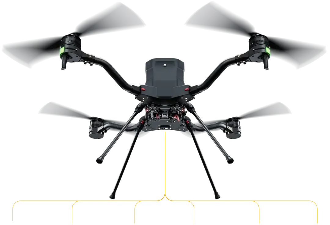
The H4C's folded profile allows single-operator transport in a standard hard-shell case. From transit to airborne in under 90 seconds — built for operations where time is a tactical asset.
Drag the slider to model real-world mission profiles. All data sourced from controlled flight tests at MSL. Results may vary by altitude, temperature, and wind conditions.
* Performance tested at sea level, 20°C, no-wind conditions. At 12,000 ft service ceiling, expect ~15% flight time reduction. Payload includes all sensor and mounting hardware weight.
Intelligent batteries with built-in BMS, featuring active monitoring and cell balancing.
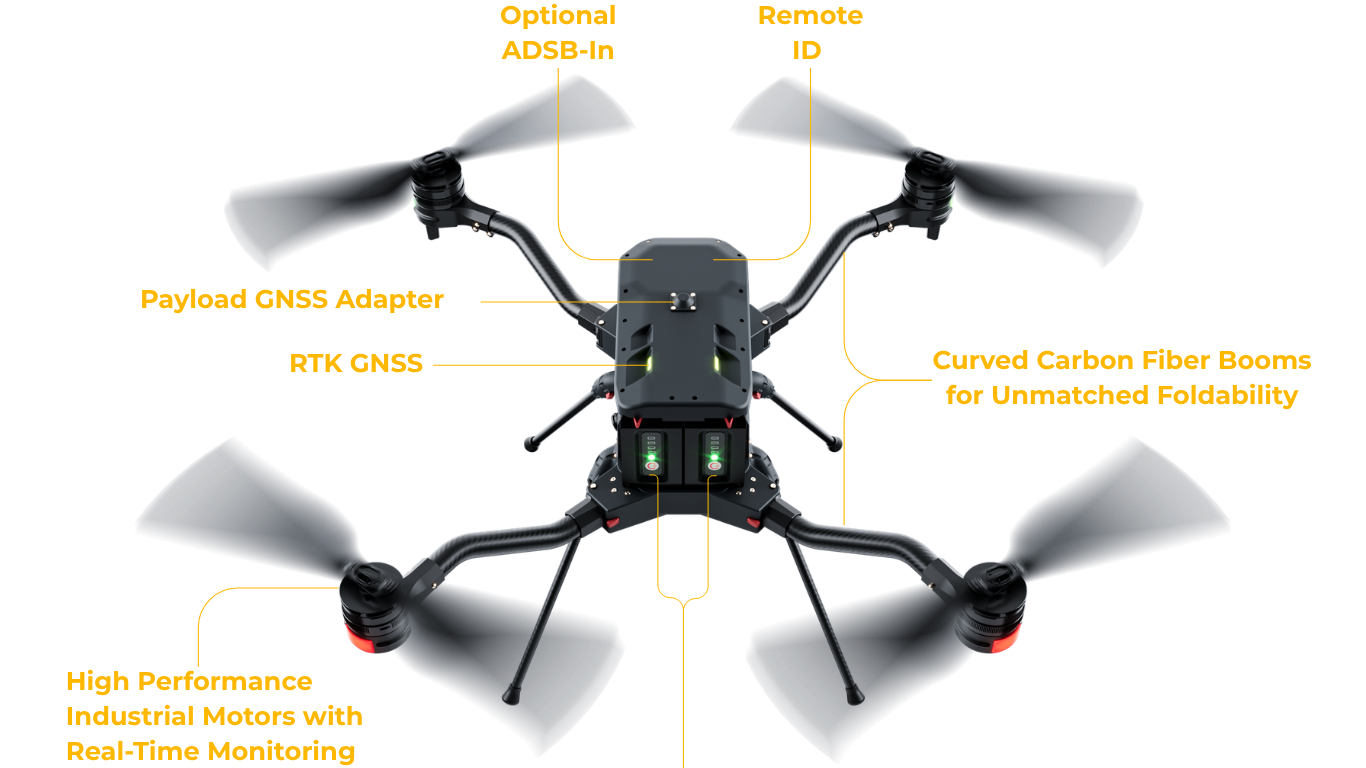
Provides survey-grade precision down to centimeter-level. Natively supports NTRIP workflow.
The built-in rangefinder provides feedback to actively track terrain and correct altitude in real time.
Built-in mission computer for GNSS-denied navigation, obstacle avoidance, and custom applications.
From precision agriculture to critical infrastructure inspection, the H4C's versatility makes it the platform of choice for professionals who can't afford failure.
Sub-2cm GSD mapping at 120m AGL with any compatible multispectral payload. Generate NDVI maps, identify crop stress zones, and plan variable-rate applications in a single flight.
RTK-precision aerial surveys for construction, mining, and land management. Capture photogrammetry data over hundreds of acres per flight at centimeter accuracy.
Up to 50-minute endurance enables wide-area SAR operations with thermal imaging payloads. Cover terrain inaccessible by ground in minutes. Operate in -20°C environments.
Deploy rapidly to emergency scenes with 15km C2 range and BVLOS capability. Carry communications relays, spotlights, or supply drops in a single airframe.
Full technical specifications, payload compatibility matrix, application case studies, and ordering information — in a single field-ready PDF.