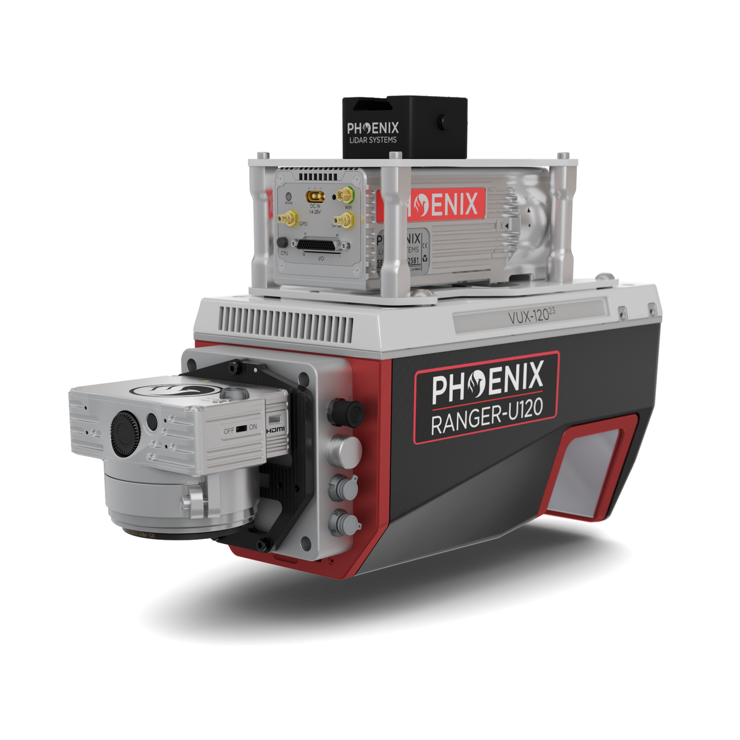
Phoenix RANGER-U120
Forward, NADIR, and Rear-Looking FOV for Efficiency
An airborne laser scanner delivering a rare combination of lightweight design, range, accuracy, and pulse rate — featuring the Riegl VUX-12023 with a three-faceted forward, NADIR, and rear-looking mirror engineered to minimize laser shadowing and capture detailed geometry on complex vertical structures in a single pass.
Take a Closer Look
Click the image to enlarge it.
Built for High-Density Corridor Mapping
A 100° field of view and pulse rates up to 2,400 kHz, purpose-built for power line, railway track, and pipeline inspection.
Three-Faceted Mirror
A virtual multi-laser configuration via the −10° / 0° / +10° mirror improves mapping of vertical surfaces in a single pass.
Survey-Grade Accuracy
2.5–5 cm RMSEz system accuracy at 350 m, with 2 cm RMSDz intraswath precision at 120 m.
2,400 kHz Pulse Rate
An extremely fast pulse repetition rate from the Riegl VUX-12023 captures high point density across long corridors.
Modular Camera Options
RGB camera options ranging from 24 MP to 120 MP for maximum project flexibility, plus UAV and manned aircraft attachment options.
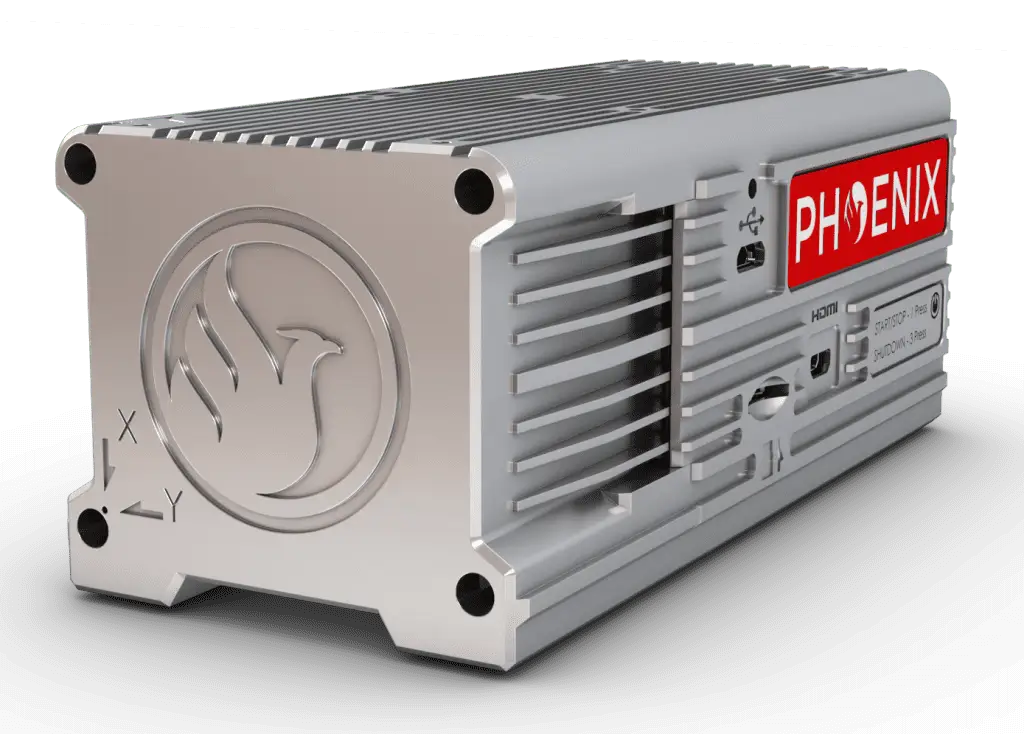
Featuring the Phoenix LiDAR Systems AIR NavBox
The newest-generation, ultra-lightweight rover increases flexibility on two fronts — reducing weight for longer flight times, and supporting higher range with the highest-resolution cameras on the market. Industry-altering capability in a box not much bigger than a standard computer mouse: 58.5 × 123 × 48.1 mm at just 450 g.
Where the RANGER-U120 Flies
Unveiling the Power & Performance Details
| Laser Wavelength | 1550 nm |
|---|---|
| Range Minimum | 5 m |
| Range Maximum | 760 m @ 20% reflectivity, 150 kHz |
| Pulse Repetition Rate | Up to 2,400 kHz |
| Scan Speed | 50 - 400 lines/second |
| Horizontal FOV | 100° |
| Scan Pattern | Three-faceted mirror (−10°, 0°, +10°) |
| Beam Divergence | 0.4 mrad |
| Laser Accuracy (Precision) | 10 mm (5 mm) 1σ @ 150 m |
| RMSEz System Accuracy | 2.5 - 5 cm @ 350 m |
|---|---|
| RMSDz Intraswath Precision | 2 cm @ 120 m |
| Max AGL @ 20% Reflectivity | 440 m |
| Operating Flight Altitude | Up to 720 m / 2,350 ft |
| Operating Voltage | 14 - 28 V DC |
|---|---|
| Power Consumption | 60 W typical |
| Operating Temperature | 32° - 104° F |
| Weight (without accessories) | 3 kg / 6.5 lbs (approx.) |
| Dimensions (W x D x H) | 58.5 x 123 x 48.1 mm |
|---|---|
| Weight | 450 g |
What's Included
- Phoenix LiDAR Systems AIR NavBox — ultra-lightweight 450 g rover
- LiDARMill cloud platform — post-processing, reporting, and hosting
- Camera options — 24 MP to 120 MP RGB available
- Drone kits — UAV, VTOL, and helicopter mount options
- Optional upgrades — IMU upgrades, heli mount, accessory mounting
Contact Us for a Free Quote Today
Build the LiDAR system you need to meet the growing demands of your clients.