
GeoCue TrueView 1
Your Gateway to Precision and Affordability in LiDAR Technology
The TrueView 1 puts you in control: choose from a 26 MP, 45 MP, or 61 MP camera, then select the Trajectory Correction Service that best suits your project's requirements and budget. The annual plan includes LP360 Drone plus maintenance and support — survey-grade 3D imaging, right away.
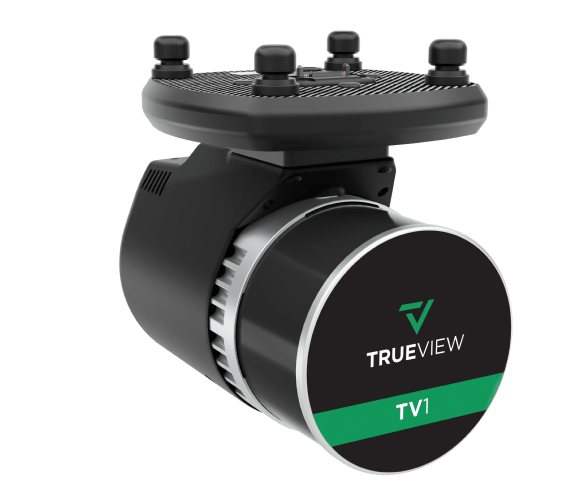
Built Around Your Project
Choose your camera, choose your correction service, and start capturing advanced 3D imaging. Click the image to enlarge.
Precision and Affordability, Your Way
Configure the camera and correction service to match your work — survey-grade results at an entry-level cost, with LP360 Drone in the box.
Configurable Camera
Build your TrueView 1 around a 26 MP (good), 45 MP (better), or 61 MP (best) camera — matched to your resolution needs and budget.
Choose Your Correction
Pair with Single Base for PPK processing where you have a base station, or go Base-Station-Free for true mobility via satellite or cellular/IP.
Hesai XT-32, 640k pts/s
A Hesai XT-32 laser scanner delivers 640,000 points per second on a single return — survey-grade density at an entry-level cost.
Annual Access to LP360 Drone
A full geospatial workflow for LiDAR and imagery — visualization, QA/QC, classification, 3D editing and analysis — included with the annual plan.
Where the TrueView 1 Flies
Unveiling the Power & Performance Details
| Data Collection | LiDAR + Imagery |
|---|---|
| Laser Scanner | Hesai XT-32 |
| Point Rate (single return) | 640,000 points/s |
| Camera Options | 26 MP, 45 MP, or 61 MP (configurable) |
| Mass | 1.4 kg |
| Trajectory Correction | Single Base (PPK) or No Base Station (satellite or cellular/IP) |
|---|---|
| Processing Software | LP360 Drone (included with annual plan) |
| LP360 Drone Workflow | Visualization, QA/QC, classification, 3D editing & analysis |
| Annual Plan | Includes maintenance & support; renews after year 1 |
What's Included
- TrueView 1 LiDAR Payload
- Selected camera — 26 MP, 45 MP, or 61 MP
- GNSS Antenna
- Sensor Hardcase
- LP360 Drone Processing Software — first year, with maintenance & support
- Trajectory Correction Service — Single Base or No Base Station
- 1 year of hardware & software support
- 2 days of training — at GeoCue's Huntsville, AL office
Camera resolution (26 / 45 / 61 MP) is selected at configuration. After the first year, an annual renewal continues LP360 Drone software access, updates, maintenance, and support; renewal depends on the selected Trajectory Correction Service.
Contact Us for a Free Quote Today
Pair the TrueView 1 with the right Harris Aerial Carrier for your mission and operating environment.