USA-Made · NDAA-Compliant Drones
Footage, partner announcements, and field deployments — pulled live from the Harris Aerial channels operators actually follow
Mission footage, payload tests, and platform demos straight from the field
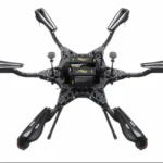
H4C Drone LiDAR Demo -- TopoDOT 2026
H6 Hybrid EFI Drone LiDAR Demo - TopoDOT Conference
Harris Aerial Drone LiDAR Demos - TopoDOT 2026
Harris Aerial H6E & RIEGL VUX 120 - IHEEP 2025
Important: No API Key Entered.
Many features are not available without adding an API Key. Please go to the YouTube Feeds settings page to add an API key after following these instructions.
Press releases, partner announcements, and engineering milestones
Real platforms. Real missions. Real customers
Showcasing our H6 Hybrid EFI carrying the Phoenix LiDAR Systems Ranger UAV 22 FLEX.
The H6 EFI Hybrid provides reliable long-endurance flight with its efficient EFI generator system, paired with the versatile Ranger 22 FLEX LiDAR for high-accuracy data collection.
This combination is engineered for demanding mapping missions including utilities, forestry, infrastructure, and large-area surveying.
American-made performance for professional operations.
#HarrisAerial #DroneMapping #LiDAR #HeavyLift UAV AerialSurvey PhoenixLiDAR #mapping

Harris Aerial participated in the @topodot Users Conference 2026 at the Rosen College of Hospitality Management in Orlando, FL in support of our partners @phoenixlidar Systems.
It was a fantastic opportunity to connect with industry professionals and showcase our next-generation drone LiDAR technology:
* H4C Quad (launching Dec 2026) with Phoenix LiDAR Systems RANGER-U120
* Carrier H6EFI Hybrid with Phoenix LiDAR Systems RANGER-UAV22 FLEX
🇺🇸 NDAA-compliant ground control stations (C-GCS & C-NAVIGATOR featured)
🇺🇸 Harris Aerial designs, manufactures, and assembles field-proven, NDAA-compliant drones for the most demanding applications — including high-performance aerial LiDAR data collection.
WATCH THE FULL CONFERENCE DEMO VIDEO HERE: https://youtu.be/Svka6n-7Fxw
#HarrisAerial #DroneLiDAR #NDAACompliant #TopoDOT2026 #PhoenixLiDAR #Drones #Surveying #Orlando #DOT #UAVs #sUAS
We are pushing the limits EVERYDAY on our H4C iterations, and we are loving every minute of it! We can’t wait for our official H4C release- GAME CHANGES SOON!
This demo featured our versatile heavy-lift drone platforms, the H4C (coming DEC. 2026) integrated with Sentera’s 65R high-accuracy RGB, 6x multispectral, and SPH’s Magnimbus magnetometer. To wrap up, we took our flagship H6 Electric with the SPH EchoSounder ECT 400S sonar for a spin to fight the high 30+ mph sustained winds and choppy surf to collect subsurface point cloud data.
At Harris Aerial, we’re obsessed with building the most reliable and versatile heavy-lift drones that make integrating advanced sensor payloads like Sentera and SPH Engineering easy while ensuring peace-of-mind during operations.
Shoutout to the @senterasensors and @sph_engineering teams for the great@collaboration!
👇 What kind of sensor payloads or integrations are you running (or looking for) in your drone operations?
🔗 Watch the demo here: https://youtu.be/Q3FpGCuR1DE
#Drones #UAV #HeavyLiftDrones #multispectral sonar
Back at Jupiter Inlet, FL— testing our prototype H4C heavy-lift platform with the @sph_engineering MagNIMBUS atomic magnetometer to detect and map magnetic anomalies with high precision.
Ultra-low flights capture clean magnetic data even in 30+ mph winds. Ideal for coastal UXO, pipeline, or subsurface surveys.
Real-world stability + terrain following on point. Harris Aerial + SPH = mission-ready.
#survey #MagNIMBUS #drone #geophysics #metal
Recent flight operations over the Jupiter Inlet in Florida, using our H4C heavy-lift quadcopter platform, demonstrated the Sentera 6X multispectral sensor’s capabilities in a coastal environment.
Key highlight: seamless integration with the 65R high-resolution payload via Smart Dovetail mount—tool-free swap in seconds, secure mechanical and electrical connectivity, enabling rapid transitions between multispectral and other payloads with minimal downtime.
Delivers synchronized high-res RGB + 5-band multispectral imagery at ~3 cm GSD, fully stabilized and geo-referenced for precise analysis.
Every H4C prototype iteration continues to prove its value for heavy-lift UAV missions requiring field-reliability, heavy payload flexibility, and easy one-operator transport ahead of its Q4 2026 release.
#MultispectralImaging #DroneMapping #PrecisionAgriculture #HarrisAerial #Sentera6X
We’re partnering with @senterasensors to put their cutting-edge 65R high-resolution RGB sensor through its paces. This beast delivers 65MP global shutter imagery (9344x7000 resolution), ultra-sharp 0.45cm/pixel GSD, exceptional color accuracy, and seamless RTK integration—perfect for precision mapping and survey-grade data.
We mounted the 65R on our prototype H4C drone (heavy-lift champ with up to 4kg payload and 50+ min flight times) and headed to the stunning Jupiter Inlet, FL for real-world testing. The coastal dynamics, inlet channels, and surrounding waterways provided a challenging environment (30+ mph sustained winds) to capture detailed aerial RGB imagery and evaluate H4C flight performance.
#dronemaxxing #mapping #suverying #inlet #coastal #H4C #Sentera #unboxing #boxing #prototype #drone #dronestagram #uav #suas #engineering
We recently spent time at the RIEGL USA calibration field collecting high-quality data with two powerhouse systems on our Carrier H6E heavy-lift drone platform:
miniVUX-3UAV-SYS – lightweight precision for detailed UAV scanning
VUX-120²³-SYS – high-density corridor & wide-FoV performance
Then we capped the day with an exciting test flight of RIEGL`s newly launched VUX-820-G topo-bathymetric LiDAR – bringing bathymetric capability to drone platforms under 55lbs.
Huge thanks to the RIEGL team for the collaboration, expertise, and shared passion for advancing aerial surveying. Moments like these remind us why we`re obsessed with building the most capable, reliable drone systems on the market.
Check out the full day in action:
https://www.youtube.com/watch?v=JcmXkkQy2aY
What topo-bathymetric or high-density LiDAR projects are on your radar? Let us know in the comments.
@riegllidar
#LiDAR #UAV #DroneMapping #BathymetricLiDAR #RIEGL #HarrisAerial #AerialSurvey #Geospatial #RemoteSensing
*Testing* LiDAR & RADAR Altimeter clearance when both the @sph_engineering Zonde Aero 500 and 1000 GPRs (ground penetrating radar) are integrated on our H6. This is important for low-flying terrain following, as the GPR sensors need to stay 1 meter above ground level over varying terrains for accurate readings.
Utilizing both RADAR and LiDAR as altimeters for terrain following gives both redundancy and versatility for different environments.
Note: both GPRs would *not* be mounted together like this in practice- this is an altimeter clearance test!
#gpr #drone #radar #lidar #engineering
From scope to delivery, every Harris Aerial system is mission-tuned in the USA — bring your payload, your radio stack, and your mission profile

