USA-Made · NDAA-Compliant Drones
Third-Generation RIEGL Integration with Three Cameras & Unlimited PP-RTX
GeoCue's third-generation RIEGL integration, built with the miniVUX-3UAV and triple mapping cameras (right, left, nadir) for high-accuracy mapping with excellent vegetation penetration and wire detection — in a lightweight payload. NDAA-compliant, with unlimited Trimble PP-RTX post-processing and an optional upgrade to dual drone and mobile mapping.
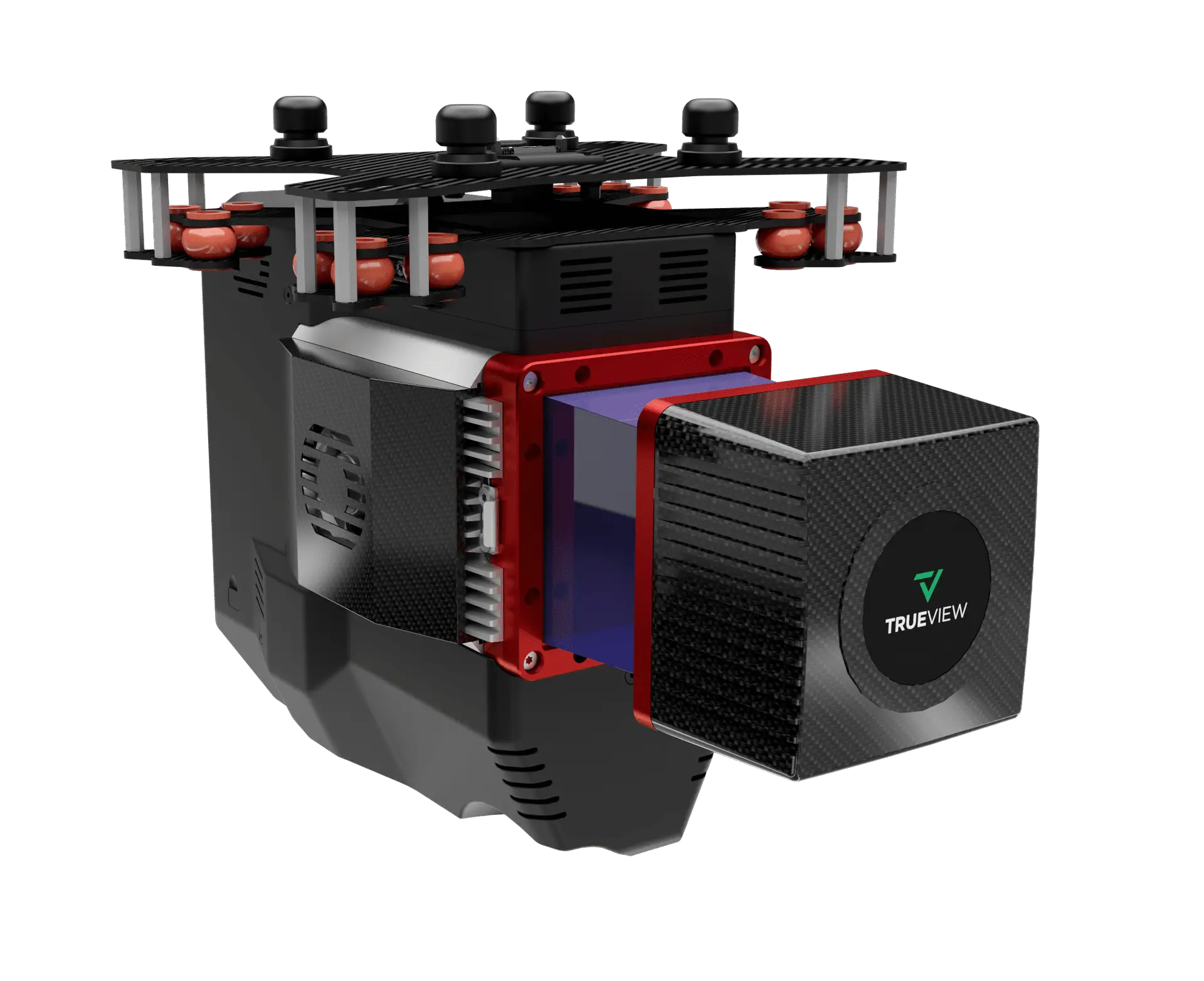
A lightweight, NDAA-compliant RIEGL integration for high-accuracy corridor and survey mapping. Click the image to enlarge.
RIEGL scanning, base-station-free corrections, and triple cameras — engineered for utility corridors, rail, and survey-grade mapping.
High-accuracy RIEGL scanning with up to 5 returns per pulse — excellent vegetation penetration and reliable wire detection in a lightweight payload.
A global, satellite-based correction service replaces a local base station — a virtual base station in the cloud delivering centimeter accuracy with no ground equipment.
Right, left, and nadir cameras (3 × Sony IMX-183, 60 MP per payload), with an optional upgrade to high-resolution Sony RX1R2 or a7r imaging.
All 655/660-series payloads are NDAA-compliant and can be upgraded to accommodate dual-purpose drone and mobile mapping.
| Data Collection | LiDAR + Imagery |
|---|---|
| LiDAR Scanner | RIEGL miniVUX-3UAV |
| Beams / Returns | Up to 5 per outgoing pulse |
| Usable Range | 100 m for targets with > 20% reflectivity |
| Pulse Repetition Rate | Up to 300 kHz (selectable) |
| Scanner Precision | 10 mm |
| Scanner Accuracy | 15 mm |
| Camera Sensor | 3 × Sony IMX-183 (1″, 20 MP, RGB) → 60 MP per payload; optional Sony RX1R2 or a7r upgrade |
| Positioning & Orientation | 655 — Applanix APX-15 | 660 — Applanix APX-20 |
|---|---|
| GNSS/INS Position | 20–50 mm |
| GNSS/INS Angle (655) | 0.025° Roll/Pitch, 0.08° Heading |
| GNSS/INS Angle (660) | 0.015° Roll/Pitch, 0.035° Heading |
| Post-Processing | Unlimited Trimble PP-RTX (no base station) |
| System Precision | Typ. 20 mm; < 15 mm (1σ) at 75 m on concrete |
| System Accuracy | Typ. 3 cm RMSE; better than 5 cm 3D RMSE |
| Mass | 655 — 2.44 kg | 660 — 2.6 kg (IMU-90) or 2.8 kg (IMU-82) |
Mass listed is the payload unit only and excludes accessories (battery, mount, antenna, power adapter). The 655 uses an Applanix APX-15; the 660 uses an Applanix APX-20. A mandatory yearly maintenance fee is required from the second year.
Pair the TrueView 655/660 with the right Harris Aerial Carrier for your mission and operating environment.