USA-Made · NDAA-Compliant Drones
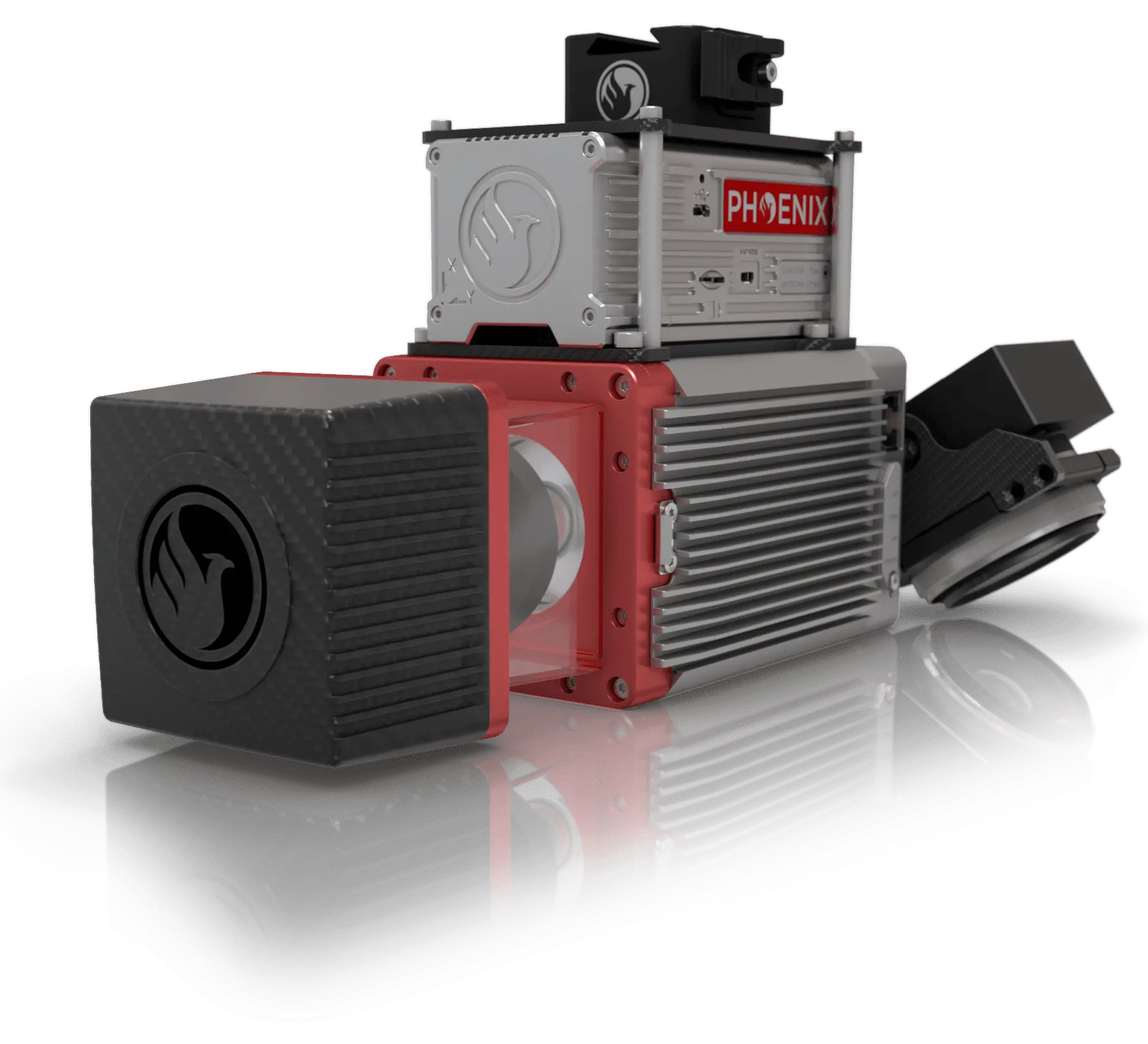
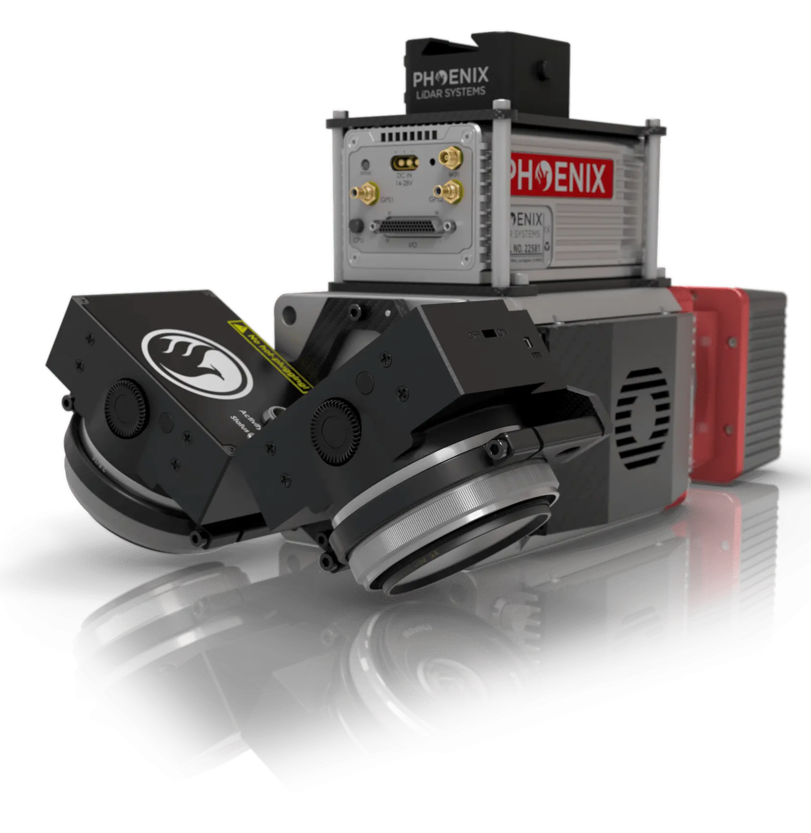
The LiDAR Scanner That's Built to Last
A miniaturized, aluminum-encased mapping system with a full 360° field of view and modest power demands — delivering up to five returns for the most demanding UAS and UAV missions, even at subzero temperatures.
Browse the gallery with the arrows or thumbnails, and click any image to enlarge it.
From mining to agriculture, construction to forestry — build the system you need to meet your clients' demands.
Centimeter-level accuracy with 250m+ laser range and outstanding intensity calibration on high-altitude, high-speed missions.
Up to five returns cut through canopy and ground cover to produce accurate, usable terrain results.
High accuracy from the latest MEMS inertial measurement units, with IMU and dual-GPS upgrade paths available.
View and analyze data in real time, or transmit live data to remote viewers over a 4G connection.
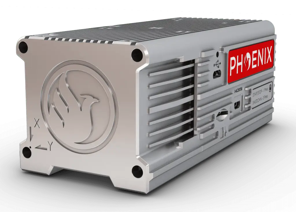
The newest-generation, ultra-lightweight rover increases flexibility on two fronts — reducing weight for longer flight times, and supporting higher range with the highest-resolution cameras on the market. Industry-altering capability in a box not much bigger than a standard computer mouse: 58.5 × 123 × 48.1 mm at just 450 g.
| Laser Properties | Class 1 (eye safe), 905 nm |
|---|---|
| Range Minimum | 3 m |
| Laser Beam Footprint | 160 mm x 50 mm @ 100 m |
| Max Effective Measurement Rate | 100,000 meas./s |
| Field of View | 360° |
| Accuracy | 15 mm one Sigma @ 150 m |
| Scanning Mechanism | Rotating Mirror |
| Mirror Speed | 10 - 100 scans/sec |
| Angular Step Width Δϑ | 0.05° ≤ Δϑ ≤ 0.5° between consecutive laser shots |
| Angle Measurement Resolution | 0.001° |
| Internal Sync Timer | Real-time synchronized time stamping of data |
| Absolute Accuracy | 10 / 15 mm RMSE @ 50 m Range |
|---|---|
| PP Attitude Heading RMS Error | 0.009° / 0.019° IMU options |
| Laser Range | 250 m @ 60% Reflectivity |
| Scan Rate | Up to 100k shots/s, up to 5 returns |
| Constellation Support | GPS, GLONASS |
|---|---|
| Support Alignment | Static, Kinematic, Dual-Antenna |
| Operation Modes | Real-time, Postprocessing |
| Accuracy Position | 1 cm + 1 ppm RMS Horizontal |
| Overall Dimensions (Sensor) | 269 x 99 x 85 mm STIM / 302 x 99 x 85 mm FOG |
|---|---|
| Overall Dimensions (Nav Box) | 300 x 99 x 85 mm |
| Operation Voltage | 12 – 28 V |
| Power Consumption | 80 W |
| Weight (incl. Sensor + Cabling) | 3.5 kg (7.7 lb) FOG IMU / 2.9 kg (6.4 lb) STIM IMU |
| Operating Temperature | -10° – +40° C |
| Dimensions (W x D x H) | 58.5 x 123 x 48.1 mm |
|---|---|
| Weight | 450 g |
Build the LiDAR system you need to meet the growing demands of your clients.