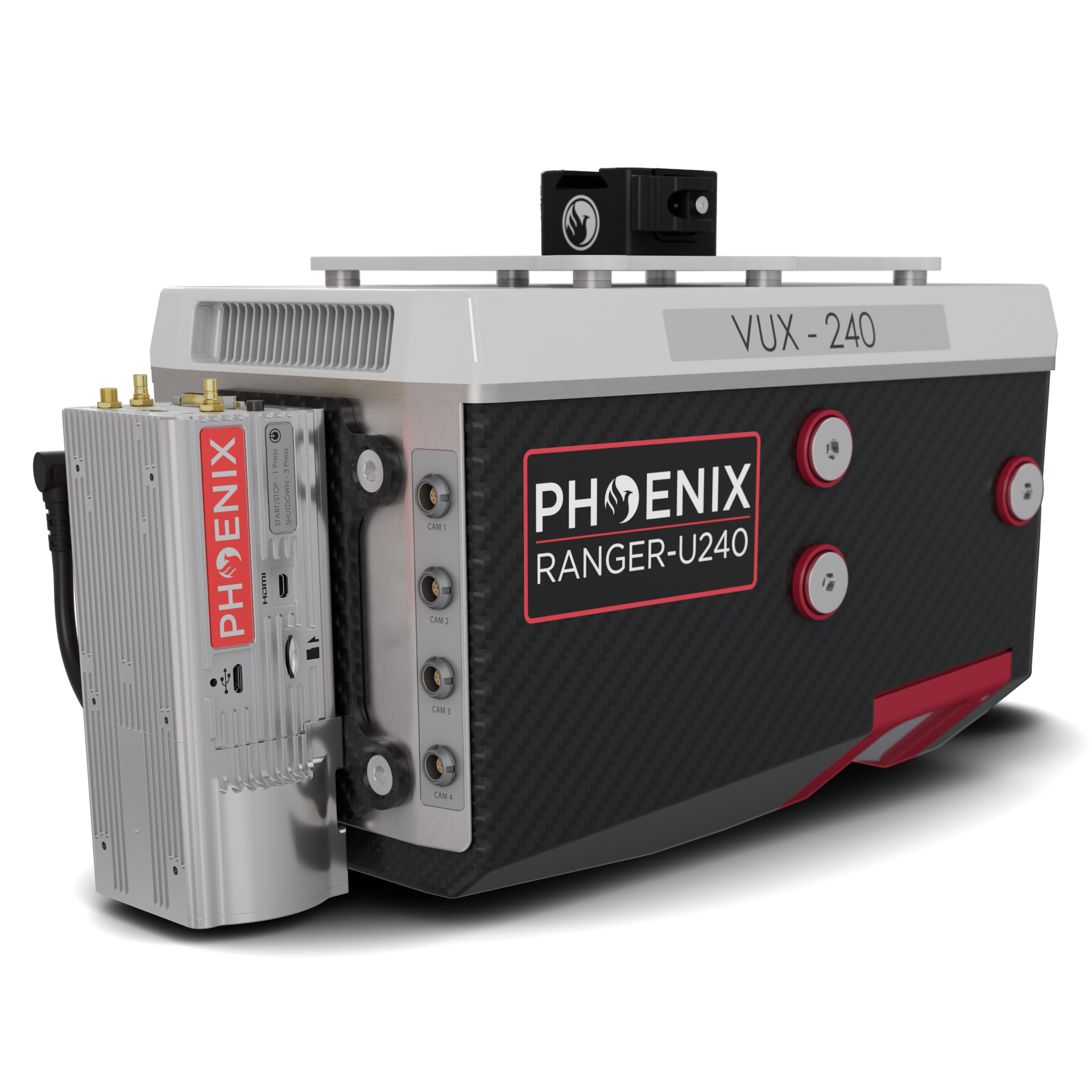
Phoenix RANGER-U240
Longest-Ranging Sensor for Wide-Area Mapping
A lightweight airborne laser scanner designed for UAS and small manned airplanes or helicopters. Featuring the RIEGL VUX-240 24, it offers a wide 75° field of view and an extremely fast data acquisition rate of up to 2,400 kHz — the longest-ranging sensor in the RANGER series, built to densely map wide areas from high altitudes.
Take a Closer Look
Click the image to enlarge it.
Wide-Area Mapping from High Altitude
A 75° field of view and 2,400 kHz acquisition rate, with an operating altitude up to 1,430 m / 4,700 ft.
Longest Range in the Series
Operating flight altitude up to 1,430 m / 4,700 ft and a maximum range of 1,200 m at 20% reflectivity — built to cover ground.
Survey-Grade Accuracy
1.5–3 cm RMSEz system accuracy at 120 m, with 1.5 cm intraswath precision. Powered by the RIEGL VUX-240 24.
2,400 kHz Acquisition Rate
Up to 2 million measurements per second across scan speeds from 40 to 600 lines per second.
Multi-Aircraft Mountable
UAVs, helicopters, gyrocopters, fixed-wing, and small manned aircraft — the same sensor adapts to the platform of the mission.
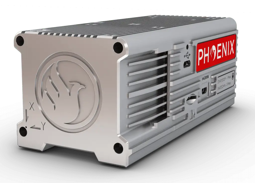
Featuring the Phoenix LiDAR Systems AIR NavBox
The newest-generation, ultra-lightweight rover increases flexibility on two fronts — reducing weight for longer flight times, and supporting higher range with the highest-resolution cameras on the market. Industry-altering capability in a box not much bigger than a standard computer mouse: 58.5 × 123 × 48.1 mm at just 450 g.
Where the RANGER-U240 Flies
Unveiling the Power & Performance Details
| Laser Wavelength | 1550 nm |
|---|---|
| Range Minimum | 5 m |
| Range Maximum | 1200 m @ 20% reflectivity, 300 kHz |
| Max Effective Measurement Rate | Up to 2,000,000 meas./sec |
| Pulse Repetition Rate | Up to 2,400 kHz |
| Scan Speed | 40 - 600 lines/second |
| Field of View | 75° |
| Beam Divergence | 0.35 mrad |
| Laser Beam Footprint (Gaussian) | 35 mm @ 100 m, 175 mm @ 500 m, 350 mm @ 1000 m |
| Laser Accuracy | 0.01 m (1σ @ 150 m) |
| Laser Precision | 15 mm |
| Laser Safety | Class 3R, ENOHD 3.5 m |
| RMSEz System Accuracy | 1.5 - 3 cm @ 120 m |
|---|---|
| RMSDz Intraswath Precision | 1.5 cm @ 120 m |
| Max AGL @ 20% Reflectivity | 890 m |
| Operating Flight Altitude | Up to 1,430 m / 4,700 ft |
| Overall Dimensions (with AIR NavBox) | 34.9 x 16.4 x 18.5 cm |
|---|---|
| Operating Voltage | 20 - 28 V DC |
| Power Consumption | 85 W typical |
| Operating Temperature | 32° - 104° F |
| Weight (without accessories) | 4.7 kg / 10.4 lbs |
| Dimensions (W x D x H) | 58.5 x 123 x 48.1 mm |
|---|---|
| Weight | 450 g |
What's Included
- Phoenix LiDAR Systems AIR NavBox — ultra-lightweight 450 g rover
- LiDARMill cloud platform — post-processing, reporting, and hosting
- Camera options — RGB camera accessories available
- Drone kits — UAV, VTOL, fixed wing, and helicopter mount options
- ULTRAPOD UP1 — Cessna and small manned aircraft pod option
- Optional upgrades — IMU upgrades, heli mount, accessory mounting
Contact Us for a Free Quote Today
Build the LiDAR system you need to meet the growing demands of your clients.