USA-Made · NDAA-Compliant Drones
GeoCue's Best 360° Field-of-View System with Three Cameras & Unlimited PP-RTX
The TrueView 680/680LR is GeoCue's best 360° field-of-view system, built with the RIEGL VUX-1UAV-22 — and the 680LR integrates the long-range RIEGL VUX-1LR-22. Choose the system that best suits your projects and trust incredible performance in both accuracy and point density. NDAA-compliant, with unlimited Trimble PP-RTX and optional dual-purpose drone and mobile mapping.
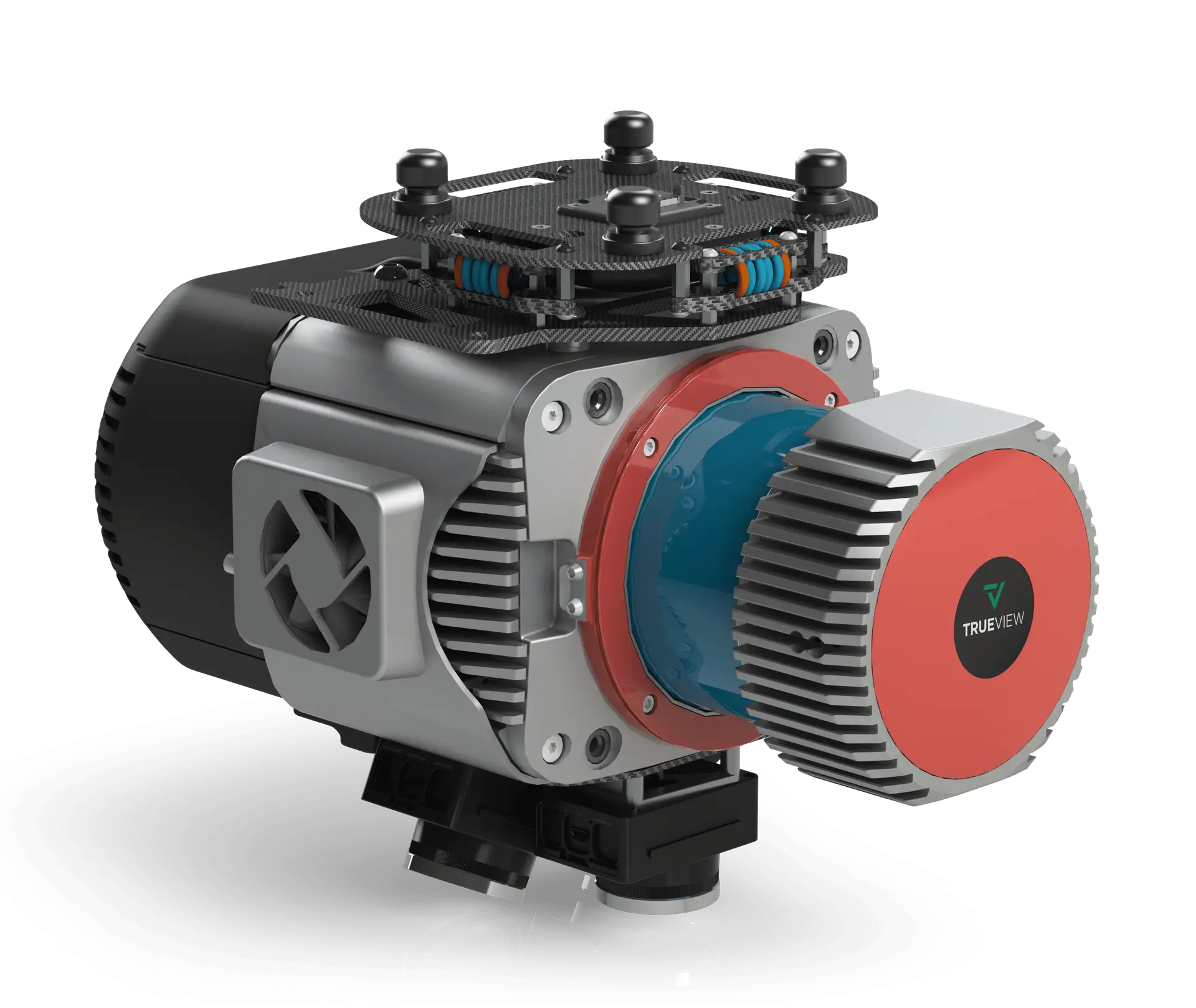
A full 360° field-of-view RIEGL system for complex terrain and infrastructure mapping. Click the image to enlarge.
A 360° RIEGL system with up to 15 returns, long-range options, and base-station-free corrections — engineered for the most demanding projects.
GeoCue's best 360° FOV system captures complex terrain and vertical infrastructure from every angle in a single pass.
Up to 15 returns with industry-leading accuracy. The 680 runs 800 kHz at 120 m; the long-range 680LR pushes 1500 kHz at 120 m.
A global, satellite-based correction service replaces a local base station — centimeter-level accuracy with no ground equipment to set up.
All 680-series payloads are NDAA-compliant and can be upgraded to accommodate dual-purpose drone and mobile mapping.
| Data Collection | LiDAR + Imagery |
|---|---|
| LiDAR Scanner | 680 — RIEGL VUX-1UAV-22 | 680LR — RIEGL VUX-1LR-22 |
| Laser Returns | Up to 15 |
| Pulse Repetition Rate | 680 — 800 kHz @ 120 m | 680LR — 1500 kHz @ 120 m |
| Scanner Precision | 5 mm (both) |
| Scanner Accuracy | 680 — 10 mm | 680LR — 15 mm |
| Camera Sensor | 3 × Sony IMX-183 (1″, 20 MP, RGB) → 60 MP per payload |
| Positioning & Orientation | Applanix APX-20 |
|---|---|
| GNSS/INS Position | 20–50 mm |
| GNSS/INS Angle | 0.015° Roll/Pitch, 0.035° Heading |
| Post-Processing | Unlimited Trimble PP-RTX (no base station) |
| System Precision | Typ. 10 mm; < 10 mm (1σ) at 80 m on concrete |
| System Accuracy | Typ. 3 cm RMSE; better than 5 cm 3D RMSE |
| Mass | 4.97 kg (payload unit only) |
Mass listed is the payload unit only and excludes accessories (battery, mount, antenna, power adapter). The 680 uses a RIEGL VUX-1UAV-22; the 680LR uses a RIEGL VUX-1LR-22. A mandatory yearly maintenance fee is required from the second year.
Pair the TrueView 680/680LR with the right Harris Aerial Carrier for your mission and operating environment.